

Want to know how to predict the weather? Look at the clouds and see if you can identify them. Cloud types give you clues about what’s going on in the atmosphere and can sometimes alert you to weather changes ahead.
Everyone has seen clouds in the sky. And you may have observed that some are white and puffy. Some are dark and cover the whole sky. Different kinds of clouds can mean different kinds of weather.
Clouds are made up of these tiny droplets or frozen crystals of water floating in the air.
All of the air around us actually contains some water, even if you can’t see it.
Imagine the air around you rising up, up, up into the atmosphere. At the air rises higher and further away from Earth, the air gets cooler!
And as it gets cooler, that water vapor turns into tiny droplets of water or ice.
As more and more air cools down, more droplets form together and they eventually become a cloud.
You may have noticed that clouds have different shapes and different colors. Plus, sometimes they are high in the sky and sometimes they are low.
The names of the clouds come from Latin words that describe what they do! For example:
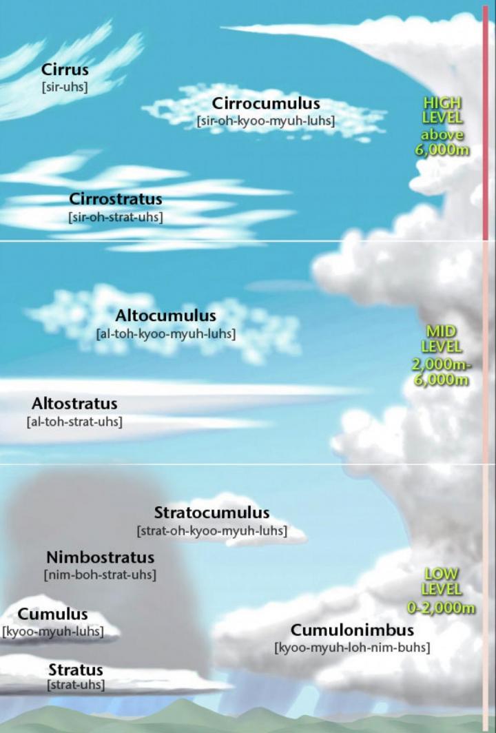
The basic cloud types are listed below.
These clouds form bases at about 20,000 feet. They usually are made of ice crystals only.
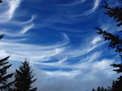
Cirrus
Cirruc clouds are thin, wispy, feathery clouds often spread across the sky. What do they look like to you? Maybe a cotton ball pulled apart? Streaming cirrus clouds are also called mare’s tails. Can you see why? They are thin because they are made of ice crystals instead of water droplets.
A blue sky and a few cirrus clouds high in the sky usually means it is going to be a pleasant day.

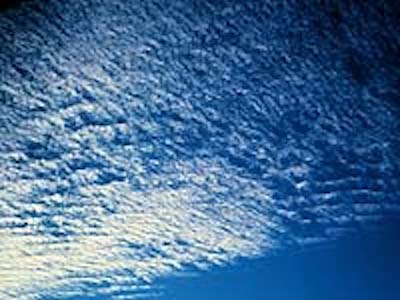
Cirrocumulus
These clouds are rippled or grainy looking. They might resemble the striped patterns of fish scales! For that reason, some people call this a “mackerel sky.”
When cirrus clouds begin to be replaced by cirrocumulus clouds, a storm may follow, which accounts for the folk saying, “Mackerel sky, storm is nigh.”
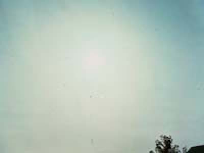
Cirrostratus
These clouds appear as thin sheets that stretch across the sky. At times, they do not appear to be separate clouds at all but give the sky a whitish appearance. These clouds can indicate the approach of rain.
These clouds form bases from about 6,500 to 20,000 feet. They usually are made of water droplets, but can sometimes also contain ice crystals.
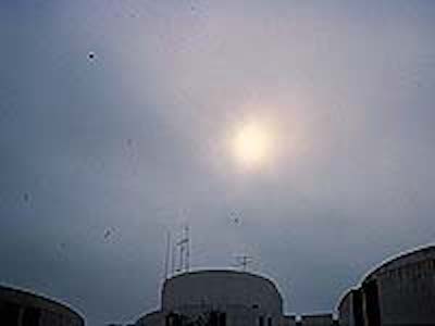
Altostratus
These clouds are most often seen as bluish-gray sheets that cover all or most of the sky. At times, they are so thick that they hide the Sun, which then appears as nothing more than a light area in the sky. Altostratus clouds often appear a few hours ahead of a warm front that brings rain!
Altocumulus
These clouds most often occur in distinct layers of puffy, round cloudlets. As with cirrocumulus clouds, their patterning is sometimes called a mackerel sky. Altocumulus clouds in the morning may foretell afternoon thunderstorms.
Note: Although “alto” means “high” in Latin, the word is used to describe midlevel clouds.
These clouds form bases below 6,500 feet. They usually are made of water droplets only.

Cumulus
Cumulus clouds are the while puffy clouds. They look like giant cotton balls or cauliflower heads. And they can built up in height or pile up. In Latin, the word cumulus means pile.
White, fluffy cumulus clouds suggest fair, dry conditions. Fair-weather cumulus clouds do not last long. When they produce rain showers, it is most often light and brief. If you see these fluffy clouds turning dark or gray though, it is going to rain.

Cumulonimbus
Cumulonimbus clouds are cumulus clouds that have grown very high into the atmosphere. Also called thunderheads, cumulonimbus clouds have bases that are usually dark, and their tops often resemble the shape of an anvil. These clouds can accompany some of the most extreme weather, including heavy rain, hail, or snow; thunderstorms; tornadoes; and hurricanes.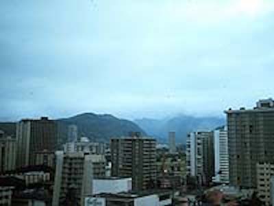
Stratus
Stratus clouds look like a huge thick grey blanket covering the sky. If they reach the ground, they become fog. Stratus clouds produce only drizzle or fine snow, if anything.
The amount of moisture in the air and the difference between warm and cold air determine how thick the cloud or fog is.

Stratocumulus
These are masses of puffy clouds with little or no space in between. A sky full of stratocumulus clouds indicates dry weather if the difference in temperature between night and day is only a few degrees. Sometimes, though, light precipitation can occur.
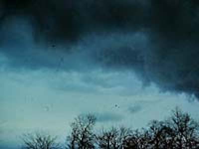
Nimbus
A nimbus cloud is dark and already has rain or snow falling from it. These clouds can be puffy or look like a blanket, but they are always dark and usually seen during a thunderstorm along with thunder and lightning.
Note: They are similar to stratus clouds, but they are darker and have rougher bases.
Some of the cloud names are very long! So, how do you pronounce them? Here’s a handy chart to help! See if you can sound out the words.
Credit: www.metoffice.gov.uk