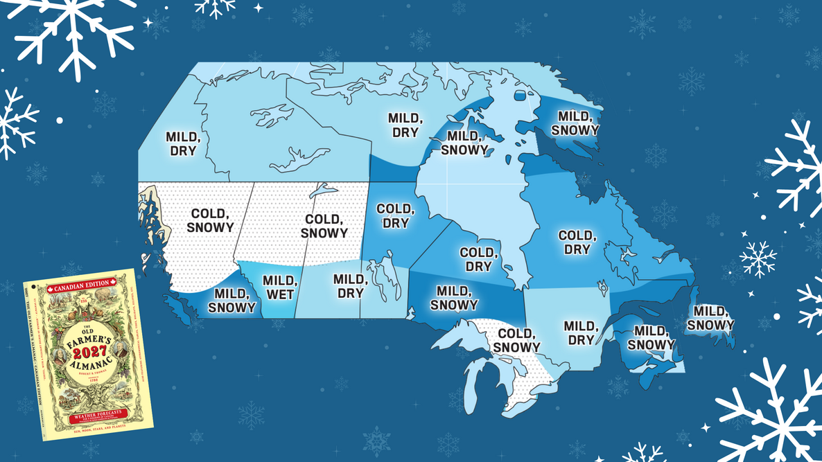
What will winter 2026–2027 bring across Canada? See The Old Farmer’s Almanac Winter Forecast for temperatures, snowfall, and the snowiest periods in your region.
- Temperatures: Most of southern Canada will be near to above normal, while colder conditions are expected in southeastern Ontario and farther north across central Canada.
- Wet/Dry: Wetter than normal in Atlantic Canada, from the western Prairies through southern British Columbia, and across southern Nunavut.
- Snowfall: Snowier than normal in Atlantic Canada, across southern Quebec and southern Ontario, from the northwestern Prairies through British Columbia, and across southern Nunavut.
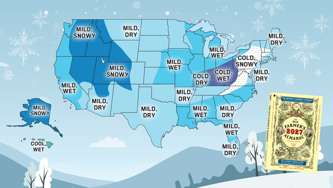
Looking for the U.S. forecast? See our 2026–2027 U.S. Winter Forecast.

Looking for the full year ahead? The 2027 Old Farmer’s Almanac Canadian Edition includes our complete 12-month long-range weather forecast.
Where Will It Be Cold This Winter?
For much of southern Canada, winter won’t be as cold as usual—but southeastern Ontario and a broad stretch of central Canada will be colder than normal.
Colder-than-normal temperatures are expected in southeastern Ontario and from northern Newfoundland and Labrador westward across central Canada, through the northern Prairies, and into central and northern British Columbia. Most of southern Canada and the far north will be near to above normal.
And remember: “Above normal” is relative. It may not be as cold as usual, but it’s still a Canadian winter!
Where Will It Be Snowy This Winter?
Snowier-than-normal areas are expected in both the East and West.
Above-normal snowfall is expected across Atlantic Canada, southern Quebec, and southern Ontario; from the northwestern Prairies through British Columbia; and across southern Nunavut.
“Canada is simply too vast for a one-size-fits-all winter forecast. This season, much of the South and far North are likely to enjoy milder-than-average conditions, while colder weather settles across parts of the middle of the country. Snow lovers may find plenty to celebrate in portions of both the East and West.”
Find Your 2026–2027 Canada Winter Forecast
Not sure of your region? Find yours here.
Jump to a region:
1. Atlantic Canada 2. Southern Quebec 3. Southern Ontario 4. The Prairies 5. Southern British Columbia 6. Yukon 7. Northwest Territories 8. Nunavut

1. Atlantic Canada
Winter gets off to a warmer-than-normal start in Atlantic Canada, but cooler days arrive with the new year. With above-normal precipitation and near- to above-normal snowfall, expect a wet winter overall.
- Temperatures: Above normal
- Coldest periods: Early to mid-January and mid-February
- Precipitation: Above normal
- Snowfall: Near to above normal
- Snowiest periods: Late December, early to mid-January, and early and late February
2. Southern Quebec
The warmer end to 2026 may feel like a distant memory once the calendar turns. Colder temperatures and snowier periods are expected in the new year.
- Temperatures: Above normal
- Coldest periods: Early to mid-January and mid- to late February
- Precipitation: Below normal
- Snowfall: Near to slightly above normal
- Snowiest periods: Mid- to late December, mid- and late January, mid- and late February, and early and mid-March
3. Southern Ontario
It may be a drier winter overall in southern Ontario, but don’t put away the snow shovel: snowfall is expected to be above normal. Eastern areas will also be colder than usual.
- Temperatures: Below normal in the east; above normal in the west
- Coldest periods: Mid- and late January and early and late February
- Precipitation: Below normal
- Snowfall: Above normal
- Snowiest periods: Early and late January and mid-March
4. Southern Prairies
A less severe winter is in store across the Prairies, with above-normal temperatures throughout the region. In the east, expect a drier winter with less snow.
- Temperatures: Above normal
- Coldest periods: Late December into mid-January and mid-February
- Precipitation: Below normal in the east; above normal in the west
- Snowfall: Near to below normal
- Snowiest periods: Late December, early January, and mid-February
5. Southern British Columbia
Get ready for a wetter, snowier winter. Northern parts of the region will run colder than normal, while farther south, temperatures are expected to be above normal.
- Temperatures: Below normal in the north; above normal in the south
- Coldest periods: Late December, late January, and early February
- Precipitation: Above normal
- Snowfall: Above normal
- Snowiest periods: Late December and early and mid-January
6. Yukon
Above-normal temperatures don’t mean a warm winter in the Yukon—it will still be plenty cold. The good news for anyone tired of shoveling: both precipitation and snowfall are expected to be below normal.
- Temperatures: Above normal
- Coldest periods: Early and late December, mid-January, and mid- to late February
- Precipitation: Below normal
- Snowfall: Below normal
- Snowiest periods: Much of November, early January, early February, and early March
7. Northwest Territories
Above-normal temperatures and less precipitation and snow may sound like an easier winter, but don’t let that fool you—it’s still winter in the Northwest Territories.
- Temperatures: Above normal
- Coldest periods: Late December, much of January, mid-February, and early March
- Precipitation: Below normal
- Snowfall: Below normal
- Snowiest periods: Early November, mid-December, and mid-February
8. Nunavut
Warmer-than-normal temperatures may provide a little relief in Nunavut, but southern areas have a wetter, snowier winter ahead.
- Temperatures: Above normal
- Coldest periods: Late December, early January, early to mid-February, and early and mid-March
- Precipitation: Below normal in the north; above normal in the south
- Snowfall: Below normal in the north; above normal in the south
- Snowiest periods: Early November, mid-February, and early March
Get the Full Year of Canadian Forecasts
Ready for the full year ahead? The 2027 Old Farmer’s Almanac Canadian Edition includes our complete 12-month long-range weather forecast, plus astronomy, gardening advice, facts, and Almanac fun for the year ahead.
Support a local store.
FIND A STORE
Use our Store Finder to enter your postal code and find the five closest stores carrying The Old Farmer’s Almanac.
Buy the print edition online.
Order the 2027 Canadian Edition on Amazon.ca.
Prefer digital?
Get instant access to the 2027 Online Canadian Edition to read on your computer or tablet. No physical book is shipped, so there are no shipping charges.

More Like This

Hi Diane,
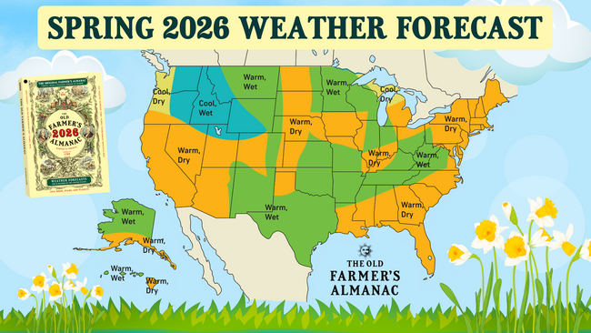
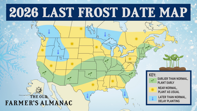
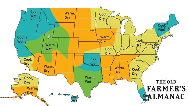
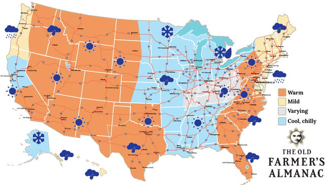
Thank you for your query. You are right that the weather should not abruptly change once it hits the border between the U.S. and Canada and it in fact does not. What does change is how the forecast can be represented by the area and how it compares to the averages.
The data used when putting together our forecasts differs on either side of the U.S.–Canada border, as the normals information for our U.S. forecasts is taken from the National Centers for Environmental Information (NOAA), while our Canadian forecasts draw from normals data collected by Environment and Climate Change Canada. So not only are the data sets put out by two different meteorological agencies for locations in each region, they also span two different sets of time—the U.S. data spans the 30-year period from 1991–2020, while Canadian data is from 1981–2010 (their data is currently being updated from the 2020 collection).
Given how normals vary widely from location to location, it is possible for areas bordering each other to have very different forecasts, which can also be seen on each map even within a specific region.
Hopefully that clears up any confusion.

Comments