
Learn About the Many Different Cloud Types
If you’ve ever looked up and wondered, “What type of cloud is that?” this piece is for the budding nephologist (person who studies clouds) in you. By observing clouds, you can predict the incoming weather! See our Guide to Clouds with pictures of common cloud types in the sky and what they mean.
Types of Clouds
Some clouds are as high as a jet; others kiss mountaintops. Some are white puffs, and some are grey and lumpy. Overall, there are three different types of clouds: high, middle, and low.
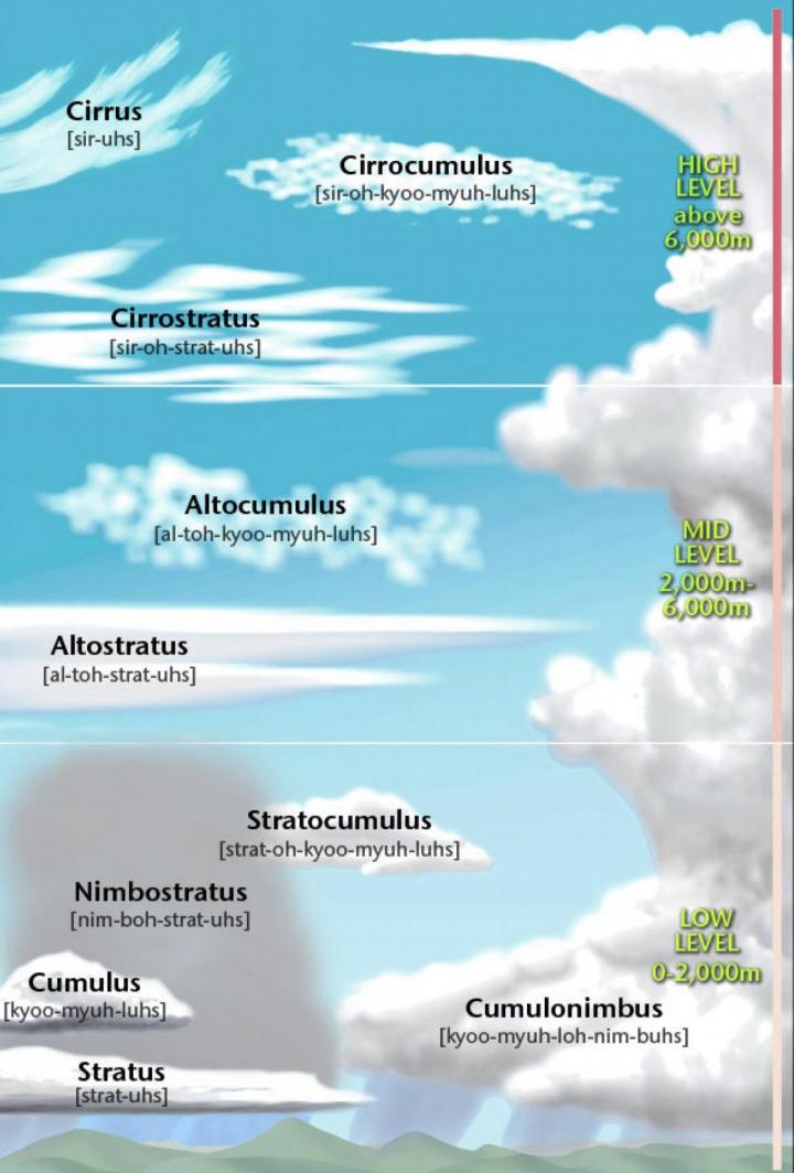
I. High Clouds
Bases start above 20,000 feet, on average
Read Next
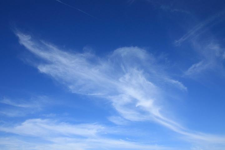
1. Cirrus: Thin, feather-like, wispy clouds, which are strands of ice crystals.
Weather prediction: A change is on its way!
2. Cirrocumulus: Thin clouds that appear as small “cotton patches.”
Weather prediction: Fair, but cold. In the tropics, hurricane potential!
Trivia: Sometimes, this is called a “mackerel sky” based on the folklore, “Mare’s tails and mackerel scales make tall ships take in their sails.” These clouds can precede an approaching warm front. Warm fronts can bring veering winds and precipitation. So, a sailor might take in his sails.

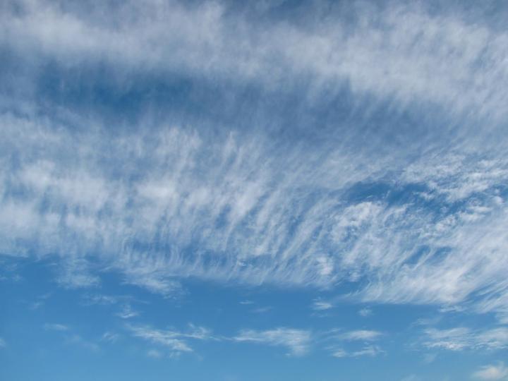
3. Cirrostratus: Thin white clouds that resemble veils that tend to cover the whole sky. They are more common in winter.
Weather prediction: Rain or snow will arrive within 24 hours!
II. Middle- to Low-Level Clouds
Bases start at between 6,500 and 20,000 feet
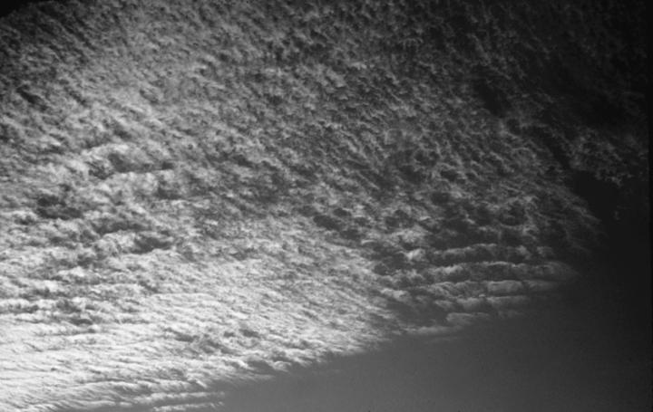
1. Altocumulus: Gray or white layers or patches of solid clouds with rounded shapes, and they often appear as fluffy ripples. They are made of liquid water, but they don’t often produce rain.
Weather prediction: Fair and pleasant!
2. Altostratus: Grayish or bluish layer of clouds that can obscure the Sun, usually covering the entire sky.
Weather prediction: Be prepared for continuous rain or snow!

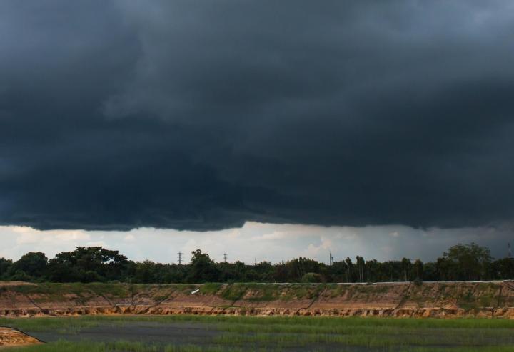
3. Nimbostratus: Dark, gray, shapeless cloud layers containing rain, snow, or ice pellets. They are often thick enough to block out the Sun.
Weather prediction: Gloomy with persistent rain or snow
III. Low Clouds
Bases start below 6,500 feet
1. Stratus: Thin, gray-white, sheetlike clouds with low bases covering the whole sky.
Weather prediction: Fair, but gloomy. They may bring drizzle or snow but won’t dump too much precipitation because they are so thin.
2. Stratocumulus: Rounded cloud masses that form in a layer. Often, they have a darkish tint instead of bright white.
Weather prediction: Fair weather for now, but a storm might be on its way.

IV. Low Clouds With Vertical Development
Form at almost any altitude and can reach more than 39,000 feet
1. Cumulus: Fluffy, white, cotton-ball clouds with flat bases and dome-shaped tops.
Weather prediction: Fair weather is in store!
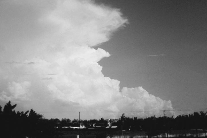
2. Cumulonimbus: Large, dark, vertical clouds with bulging tops that can grow to towering heights on hot, humid days.
Weather prediction: These bring showers, thunder, and lightning.
Want to see more cloud pictures? Imagine clouds shaped like jellyfish and flying saucers! See Rare Clouds and Pictures.
Catherine Boeckmann


A very interesting article...sharing this info w my grands!
My mom always said that the Cirro Nimbus was the Shepard gathering his Flock before a Rain
My mom used used to call cumulonimbus “cum-oo-lus boom-oo lus.”
My grandmother called cirocumulous(sp) clouds 'a buttermilk sky'. I always knew that she meant rain was coming!
I’m surprised that there’s no pilots commenting. When flying you’re in an ocean of air and like on water are subjected to three axis motions at once: the ‘X’, ‘Y’ & ‘Z’ as defined. In the air element you’re subject to visibility as well as defined by cloud types. Clouds give an indication of the air conditions, knowing them can make or break a good flight. Clouds or ground fog (a cloud) forms when the dew point and temperature is within a couple of degrees. Being a pilot, I always am aware of cloud conditions, even when walking, it’s conditioning of the elements. Even when on the road. When you see various layers of clouds, that a place where the dew point and temperature combine.
When flying in a single engine (or more) or a glider I watch Hawks over mountain ridges, they circle in the up drifts to gain altitude. Dangerous clouds like the Lenticular clouds (look like flying saucers!) as shown in OFA’s article https://www.almanac.com/rare-clouds-pictures are actually the peak of the air movement over high mountains, very turbulent. Never get near a thunderstorm. Mt. Washington in NH has very rough air and clouds. Flown over it many times, average winds are 40 MPH, strong up and down drafts. Highest recorded winds were 237 MPH. Mountains cause clouds, when winds increase due to the venturi affect of being squeezed between the Troposphere and the ground, they pick up like on Washington.
In commercial airplanes, don’t unbuckle your belt, you could be scraped off the ceiling. Don’t know when the plane runs into CAT (Clear Air Turbulence). Your not setting on your couch, just loosen the belt somewhat. Many injuries have been caused. I have received better weather observations from the TV weather than FAA Flight Service, knowing where the fronts are and how fast dictates a good flight or not. I have an Instrument rating and been in all types of air conditions. Many time very glad to have a seat belt.
Clouds let you know a lot about the air we breathe. I’ve seen contrails having been in the Air force, a lot of flying producing contrails. Also have seen many chemtrails, some covering the entire sky in the US without disbursing rapidly. They are also seen in the UK and AU. There’s more to clouds than you see.
Most of the clouds we see today are not natural they are climate engineering from governments.
For those clouds that indicate a change in weather, how soon after their appearance could one expect to see the shift in weather?
Thanks for the cloud / weather information; very interesting!!
Good Morning,
Regarding the types of clouds which form in the sky, would someone please explain why we have multiple planes going over day and night leaving long trails which morph into clouds and completely block out the sun. I have been told this is normal contrail activity but I cannot believe this. Thank you for any info.
Regards,
Noreen
Geoengineering.org is a great source.