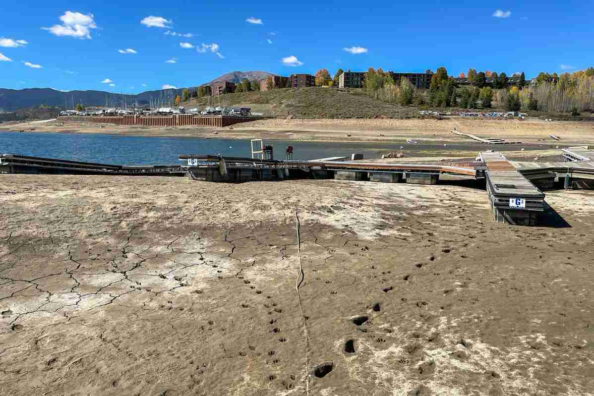
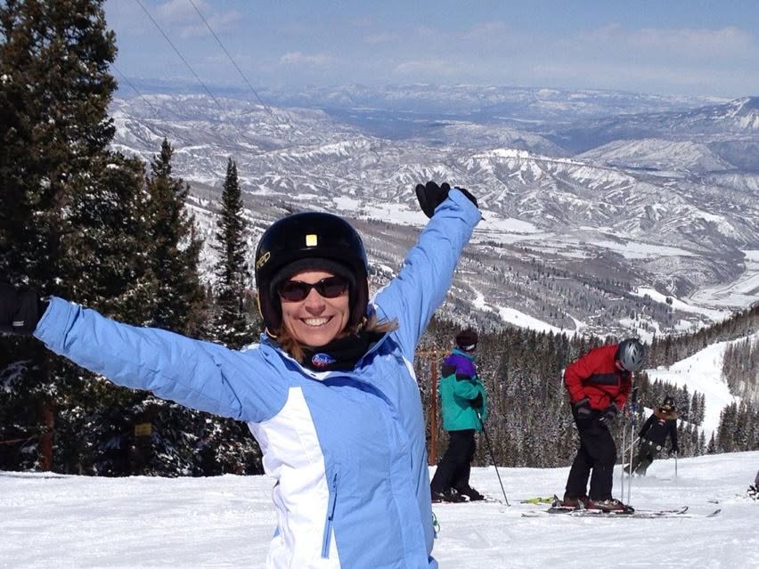
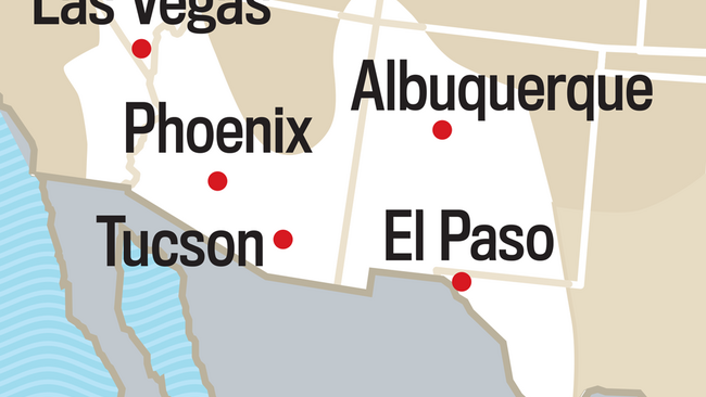
Denver resident Carolyn Mayle hopes for a better ski season this winter—but she’s more concerned about drought. “This past year we had restrictions on watering our lawns, and farmers had lower crop yields,” she says. Without a good snowpack, she worries about worsening water shortages and wildfires.
Carolyn’s hopes for snow depend on El Niño, a climate pattern that can bring more snow or rain to some regions. It’s now on track to be strong to very strong this winter, according to NOAA. Some have nicknamed it a Super El Niño. It’s arriving in an increasingly warmer world. What could that combination mean for your winter: more snow, heavier rain, or milder days?
How Can a Distant Ocean Affect Your Winter?
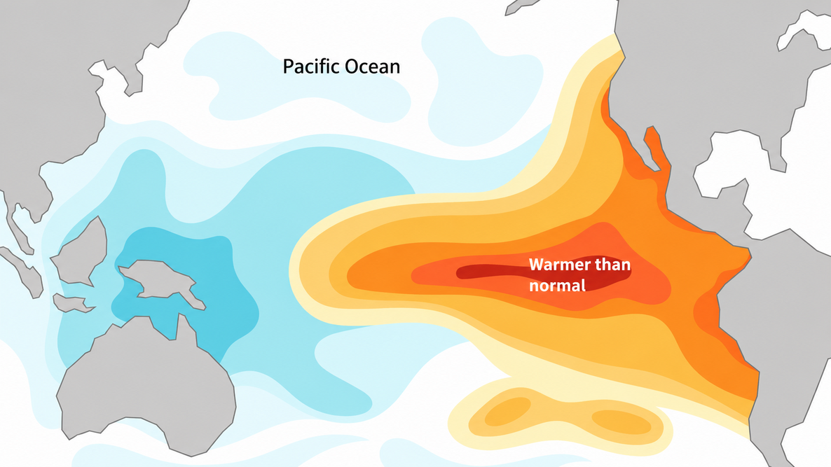
Strong El Niño winters often bring milder temperatures across much of the U.S., along with wetter conditions in parts of the West and South.
It starts when the tropical Pacific warms. That changes where the ocean releases heat into the air above it, which can shift the jet stream, the fast-moving river of air that steers storms. When the jet stream shifts, the weather systems it steers can shift too.

How Could El Niño Affect Winter 2026–2027?
El Niño is only one piece of the winter puzzle, so The Old Farmer’s Almanac’s weather outlook varies by region. (If you’re not sure which long-range weather region you’re in, check the regional map.)
United States
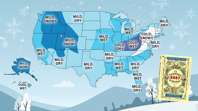
Cold air will extend from central New England south through the Appalachians and into the Ohio Valley, where temperatures will run below normal. Hawaii will also be cooler than usual, though not dramatically so.
Snowfall will be above normal from central New England through the Appalachians, in the Intermountain region (Region 13 on the regional map), in the Pacific Northwest, and in Alaska.
Expect wetter-than-normal conditions across much of the West and in parts of the South, Midwest, and Florida. Drier-than-normal conditions are likely in parts of the East, the Plains, and the Southwest.
Canada
Most of southern Canada will be near or above normal for temperatures, but southeastern Ontario and farther north across central Canada will be colder than normal.
Precipitation will be above normal in Atlantic Canada, from the western Prairies through southern British Columbia, and across southern Nunavut. Snowfall will be above normal in Atlantic Canada, southern Quebec, and southern Ontario, from the northwestern Prairies through British Columbia, and across southern Nunavut.
For the Almanac’s winter weather map and regional summaries, see the U.S. Winter Forecast and the Canadian Winter Forecast.
What Is a Super El Niño?
This year’s El Niño has grown into an exceptionally powerful event, with the potential to become one of the strongest on record.
Almanac meteorologist Chad Merrill explains its influence on our winter forecast:
“We’re experiencing a Super El Niño, which means you can credit the strong footprint of El Niño for the 2026–2027 winter weather forecast.”
— Chad Merrill, Almanac Meteorologist
What makes an El Niño super? Scientists measure its strength by how unusually warm the tropical Pacific Ocean becomes—not by how much rain or snow falls.
A very strong El Niño reaches a temperature index of at least 2.0°C (3.6°F) above its reference level. This year’s event has now crossed that threshold, joining a small group of exceptionally powerful El Niños since 1950. NOAA’s ocean temperature data show just how unusual this event has become.
And it may grow stronger. Climate models suggest that ocean temperatures could continue rising into December, potentially setting new records, according to Carbon Brief’s analysis.
But here’s the important distinction: A stronger El Niño doesn’t necessarily mean stronger storms. Instead, it increases the likelihood of certain winter weather patterns, from heavier precipitation in some regions to unusually warm or dry conditions in others.
The outcome depends on where you live—and whether cold air is in place when storms arrive.
Rain or Snow? It Comes Down to Cold Air
Wetter doesn’t always mean snowier. Snow needs two things: moisture from a storm and cold air near the ground. Without enough cold, the same storm brings rain.
The Almanac forecasts precipitation and snowfall separately, so check both. A region can be wetter than usual and still see less snow.
A Strong El Niño in a Warmer World
The Pacific’s unusual warmth is already visible. In the chart below, the dark red line shows this year’s ocean temperatures in the central Pacific near the equator, well above the historical average shown in black. These are temperatures recorded so far this year, not a forecast.

Looking further ahead, scientists predict the world will warm by roughly 5°F (2.8°C) by the end of this century. That’s almost double the target of 2.7°F (1.5°C), which remains in place even though the world isn’t on track to meet it. These increases are measured against global temperatures before the industrial era.
El Niño comes and goes, but the warming behind it lasts much longer. A warmer ocean and atmosphere can amplify some of El Niño’s effects. Warmer air can hold more water vapor, giving storms more moisture to draw on—and potentially bringing heavier downpours.
For families, farmers, and communities, how that water arrives matters. Gentle rain can soak into dry soil, while heavy runoff can carry away topsoil. Snow can store water for months before melting, while rain soaks in or runs off sooner.
A Winter Worth Hoping For
For Carolyn, a strong El Niño brings hope that winter snow could eventually ease water shortages. In mid-October, NOAA reported that El Niño could favor wetter conditions in parts of the Intermountain West this winter.
For farmers and ranchers who depend on snowmelt, a snowy winter could mean more water for crops, hay fields, and livestock next spring. But even a good snow season won’t fully replenish the region’s depleted major reservoirs. Recovery will take time.
There’s also reason for skiers to be hopeful. According to Almanac meteorologist Chad Merrill:
“The snow season, which for the most part got off to an earlier start than last year across the Great Basin and Rockies, will likely continue deep into the spring season. This means ski resorts will likely stay open for a much longer period than last winter.”
— Chad Merrill, Almanac Meteorologist
For Carolyn, the possibility of a snowier winter brings another reason to smile: more days on the slopes with her family. El Niño can’t guarantee snow—or drought relief—but this winter offers something to hope for.
Frequently Asked Questions
-
How long will this El Niño last?
NOAA’s October 2026 outlook favors a strong to very strong El Niño through January–March 2027. Exactly when it will weaken remains uncertain.
-
When was the last El Niño?
The previous El Niño developed in 2023 and ended in 2024. These events return irregularly, generally every 2 to 7 years.
Sources
- NOAA Climate Prediction Center — ENSO Diagnostic Discussion — October 8, 2026
- World Meteorological Organization — El Niño / La Niña Phenomena
- NOAA — The Water Cycle
- U.S. Geological Survey — Snowmelt Runoff and the Water Cycle
- U.S. Geological Survey — Surface Runoff and the Water Cycle
- United Nations Environment Programme — Emissions Gap Report 2026



Comments