
Extended, Long-Range Forecast for Fall
Will the record-breaking heat let up? Take a look at our new fall weather forecast from The Old Farmer’s Almanac, covering temperatures and precipitation. Plus, we provide your regional fall forecast highlights for the U.S. and Canada.
—>For the full 12 months of forecasts, pick up a copy of The 2026 Old Farmer’s Almanac. You can now order here!
Read Next
Fall Forecast 2025 Summary
Your trek to the pumpkin patch may be a bit steamy this year. The Old Farmer’s Almanac is predicting a warmer-than-normal autumn this year! In fact, it should be quite warm for the western half of the United States!
The regions listed below will be warmer-than-average for this time of year:
- Atlantic Corridor
- Southeast
- Florida
- Deep South
- Heartland
- Texas-Oklahoma
- High Plains
- Intermountain
- Pacific Northwest
- Pacific Southwest
- Alaska
The regions listed below will be cooler-than-average for this time of year:
- The Northeast
- Appalachians
- The Lower Lakes
- Ohio Valley
- Upper Midwest
- Desert Southwest
- Hawaii
What about rainfall? For much of the United States, from California to Florida and up to Maine, we should be prepared for below-average rainfall. However, certain areas, such as the High Plains and the Pacific Northwest, should keep their umbrellas handy!
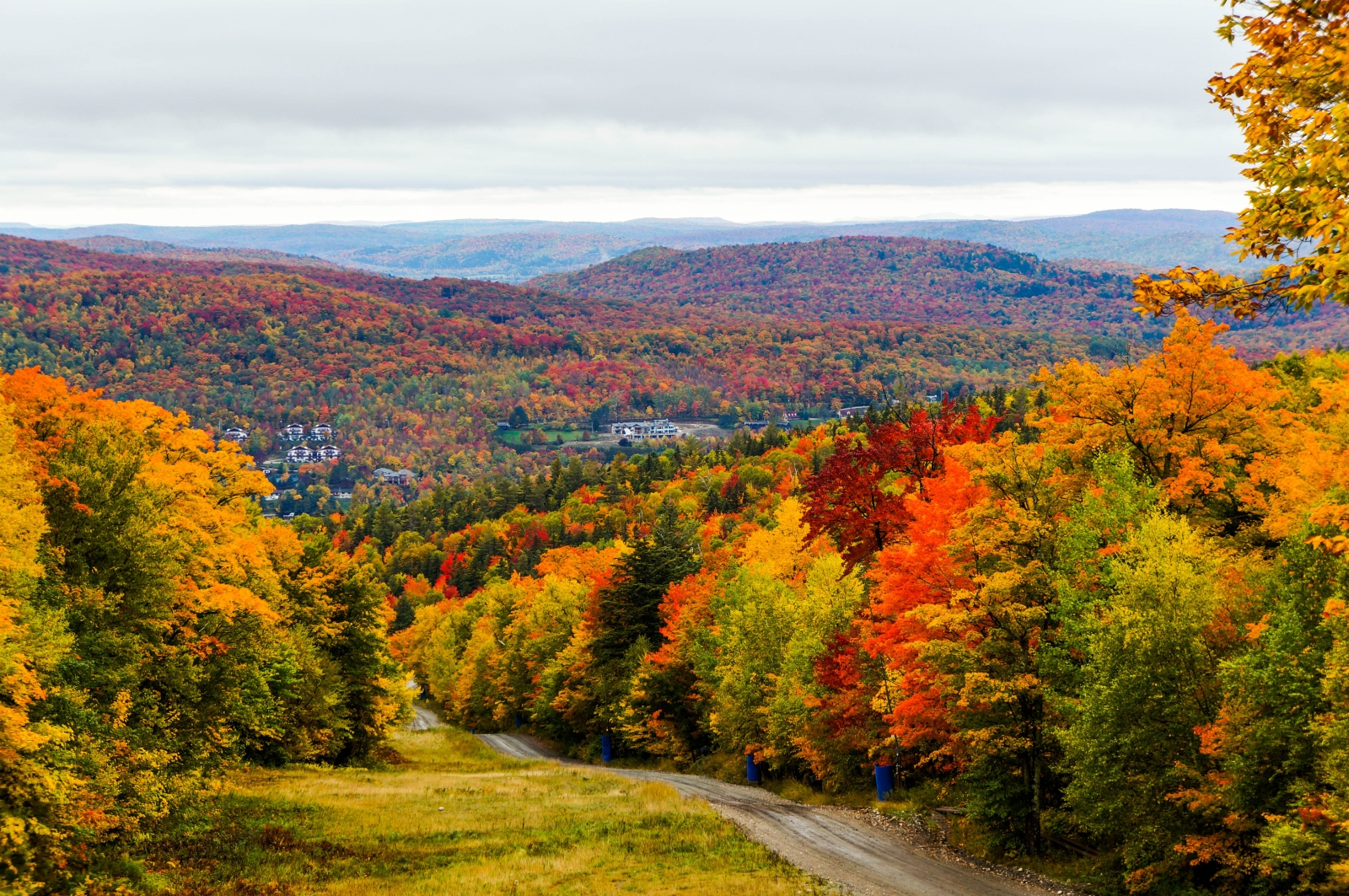
The cool temperatures and below-average rainfalls could translate to some pretty foliage in the Northeastern region. See our Fall Foliage Map here.
Hurricane season officially runs through November. We expect above-normal activity, with a high count of named storms. See more hurricane predictions.

Regional Forecasts
The Northeast
Expect cooler and drier conditions than usual. September brings an average temperature of 59°F (2° below normal) with 3.5” of precipitation—wet in the north, drier in the south. October will average 46°F (3° below normal) with just 2.5” of rain. Look for scattered showers, brief warm spells, and overall chilly weather.
Atlantic Corridor
September and October will be cooler than normal in the north and warmer in the south, with below-average rainfall overall. September: Avg. temp 70.5° (average north, 3° above south); 3” of rain (1” below normal). Expect warm weather early, some thunderstorms, then scattered showers and cooling late month. October: Avg. temp 55° (2° below normal); 4” of rain (near average). Cooler overall with scattered showers, brief warmth mid-month, and heavy rain followed by a cool finish.
Appalachians
September and October will be cooler and drier than normal overall. September: Avg. temp 65°; 3” rain (2” below normal in the north). Expect sunny, warm days early, followed by thunderstorms mid-month, then cooler with regional variations late. October: Avg. temp 53° (1° below normal); 2.5” rain (1” below normal). Cool with scattered showers early to mid-month, then dry and warming to close the month.
Southeast
September and October will be warmer than normal, with below-average rainfall. September: Avg. temp 78° (3° above normal); 4” rain (1” below normal). Expect mostly warm, stormy conditions with a cooler finish. October: Avg. temp 64° (1° below normal); 1.5” rain (1.5” below normal). Sunny and warm early, with light showers mid-month and a cooler end.
Florida
The fall will be warmer and drier than normal. September: Avg. temp 82° (1° above normal); 4.5” rain (3” below normal). Expect warm weather with scattered thunderstorms early and mid-month, then cooler with regional showers late. October: Avg. temp 76° (near normal); 2.5” rain (2” below normal). Mostly sunny and mild, with a few scattered showers and a cooler finish.
Lower Lakes
This fall will be cooler and drier than normal overall. September: Avg. temp 62°; 2.5” rain (0.5” below normal). Expect a mix of showers and sun, with periods of warmth early and mid-month, then cooling late. October: Avg. temp 51° (2° below normal); 2” rain (1” below normal). Scattered showers early and mid-month, followed by sunny, cool days and a mild end to the month.
Ohio Valley
September and October will be cooler and drier than normal across the region. September: Avg. temp 68° (slightly above east, below west); 2” rain (1” below normal). Expect warm periods with scattered showers early and mid-month, then turning cooler. October: Avg. temp 56° (2° below normal); 2” rain (0.5” below normal). A mix of showers and sunshine with shifting temps—warm early, cooling mid-month, then slightly warmer to end.
Deep South
September and October will be warmer than normal, with below-normal rainfall in the north and near-normal amounts in the south. September: Avg. temp 79° (2° above normal); 3.5” rain (1” below normal). Hot and sunny early, followed by scattered thunderstorms mid-month, then cooler with sunshine to end. October: Avg. temp 65° (1° below normal); 2.5” rain (drier north, wetter south). Warm and sunny early and late in the month, with some storms and showers mid-month.
Upper Midwest
September and October will be cooler and drier than normal overall. September: Avg. temp 57° (2° below normal); 3.5” rain (slightly above normal). Expect frequent rain, drizzle, and some early snow in the north, with brief warm-ups late in the month. October: Avg. temp 45° (2° below normal); 1.5” rain (1” below normal). A mix of chilly rain and snow, especially in the north, with a few sunny, warmer days mid to late month.
Heartland
Fall will begin warmer than usual in September, then trend closer to normal in October. Precipitation will be below average overall. September: Avg. temp 69° (1° above normal); 1.5” rain (2” below normal). Expect mostly sunny days with brief cool spells and light storms mid-month. October: Avg. temp 57° (normal); 3” rain (average). Warm early and mid-month with some storms, then shifting to cold, followed by a late warm-up.
Intermountain
September and October will be warm overall, with below-normal rainfall. September: Avg. temp 67° (3° above normal); 0.5” rain (0.5” below normal). Expect mostly sunny and warm conditions, especially late in the month after a brief cool spell. October: Avg. temp 52° (normal); 1” rain (average). Mostly dry and chilly with periods of sunshine, ending with a stretch of very warm weather.
Desert Southwest
September and October will be cooler than normal in the east and warmer in the west, with below-normal rainfall across the region. September: Avg. temp 82° (2° above normal); 0.7” rain (average east, below west). Expect warm to hot days with scattered storms early, then sunny and very warm through month’s end. October: Avg. temp 67.5° (cool east, average west); 0.5” rain (below normal). Mostly sunny with a few light showers and fluctuating temps—cool mid-month, warming late.
Pacific Northwest
September and October will be warmer and wetter than normal overall. September: Avg. temp 63° (1° above normal); 1” rain (slightly below normal). A mostly sunny month with brief cool spells and light rain early and mid-month, then turning very warm late. October: Avg. temp 57° (2° above normal); 4.5” rain (1” above normal). Expect a mix of sunny and rainy periods, with mild to warm temperatures throughout.
Pacific Southwest
September and October will be warmer than usual in the north and drier across the region. September: Avg. temp 72.5° (warmer north, cooler south); 0.1” rain (near normal). A dry, sunny month with warm-to-hot weather in the north and cooler temps in the south. October: Avg. temp 67° (1° above normal); 0.2” rain (slightly below normal). Expect mostly sunny skies, with brief showers and a warm finish to the month.
Alaska
Fall in Alaska will be milder than normal, with below-normal precipitation in the north and near to slightly above normal in the south. September: Temps average 36.5° in the north, 57° elsewhere (2° above normal); precipitation 0.6” north (below normal), 9.5” south (above normal). Expect early rain and showers, with sun in the north mid-month and increasing snow and rain late. October: Temps 25° north, 48° south (5° above normal); precipitation 0.3” north, 5” south (both below normal). A mix of rain, snow, and occasional sunshine, with warmer-than-usual conditions overall.
Hawaii
Fall will be slightly cooler than normal across the islands, with the hottest period in mid to late September. Rainfall will be above average in the east and west, but drier in central areas like Honolulu. A tropical storm may affect the region in late September. September: Avg. temp 81° (0.5° below normal); 3.3” rain (much wetter E&W). Expect warm days with frequent showers, especially mid-month and during a possible tropical storm late in the month. October: Avg. temp 79° (1° below normal); 1” rain (drier than normal). Early and mid-month bring scattered showers, followed by a sunnier, milder finish.
Fall Forecast for Canada
Temperatures this fall will trend cooler than normal from Atlantic Canada through southern Ontario, while the rest of the country will see near- to above-normal warmth. Most areas can expect above-average precipitation, except for very southern Ontario and southern British Columbia, where it will be near or below normal.
A tropical storm threat is possible in Atlantic Canada in early September, so early-season storm preparedness is advised.

Atlantic Canada
September and October will be cooler than normal, with above-average rainfall. A tropical storm may threaten early in September. September will bring average temps around 13°C (1°C below normal) and heavy precipitation (160mm, 55mm above average). Expect a tropical storm early in the month, followed by a mix of chilly sun, rain, and mild spells. October will continue the trend with cooler temps (7.5°C, 1°C below normal) and 135mm of rain (15mm above normal). Rainy and chilly periods dominate, with occasional sunshine breaking through in the west.
Southern Quebec
Southern Quebec is expected to have a cooler-than-normal fall with mostly above-average rainfall. September: Average temperature will be around 13°C (1°C below normal) with 120mm of precipitation (30mm above normal). Expect alternating periods of sun and rain throughout the month, with generally cool conditions. October: Temps will average 7°C (1°C below normal) and precipitation will total about 80mm (5mm below normal). Early and mid-October bring scattered showers and chill, followed by a warm spell around mid-month and a return to cooler, showery days to close the month.
Southern Ontario
Southern Ontario is looking at a cooler-than-average fall with mixed precipitation trends—above normal in the north, but below normal in the south. September: Expect an average temp of 13°C (2°C below normal). Rainfall will average 120mm—60mm above normal in northern areas, while the south sees closer to normal amounts. Early September brings thunderstorms and a mild start, followed by several rainy, chilly periods and some sunny breaks toward the end of the month. October: Temperatures will hover around 9°C (1°C below normal) with 65mm of precipitation (10mm below average). The month begins chilly with sun and light showers. Mid-month may see some warmth and thunderstorm activity before ending on a mix of sunny days, occasional rain, and even a chance of early snow.
The Prairies
The Prairie provinces can expect a warmer and wetter-than-normal autumn. September: Temperatures will average 12°C (1°C above normal), with around 45mm of precipitation—right on average. The first part of the month will bring isolated showers and a cool dip, but mid to late September will trend warmer with thunderstorms and lots of sunny, very warm days to close out the month. October: Temperatures rise even more to 8°C (2°C above normal), with 30mm of rain (5mm above average). Expect a warm, sunny start with light drizzle mid-month. Later, the west may see early flurries while the east has drizzle, before things warm up again near the end of October.
Southern British Columbia
Expect a warmer-than-normal fall with near-average rainfall across the region. September: Average temperature will be 15°C (1°C above normal), with about 100mm of rain, which is average. The month starts off sunny, followed by isolated showers later on. October: Temperatures will remain above normal at 11°C (2°C above average), with 100mm of precipitation again matching typical levels. Early October will be mostly sunny and warm, followed by a mix of isolated showers and sun, especially in the south. Cooler spells mid-month will give way to rainy but warm periods by the end.
Our long-range forecasts are derived through the employment of three scientific disciplines: solar science (the study of sunspots and other solar activity), climatology (the study of prevailing weather patterns), and meteorology (the study of the atmosphere). We predict weather trends and events by comparing solar patterns and historical weather conditions with current solar activity.
Our forecasts do not compare the year ahead to the one just past but rather to a 30-year statistical average, as prepared by government meteorological agencies. Those averages are updated every 10 years, so our current comparison period spans 1991 through 2020.
Did You Know: You can always find our 60-day extended forecast on Almanac.com.


ADVERTISEMENT