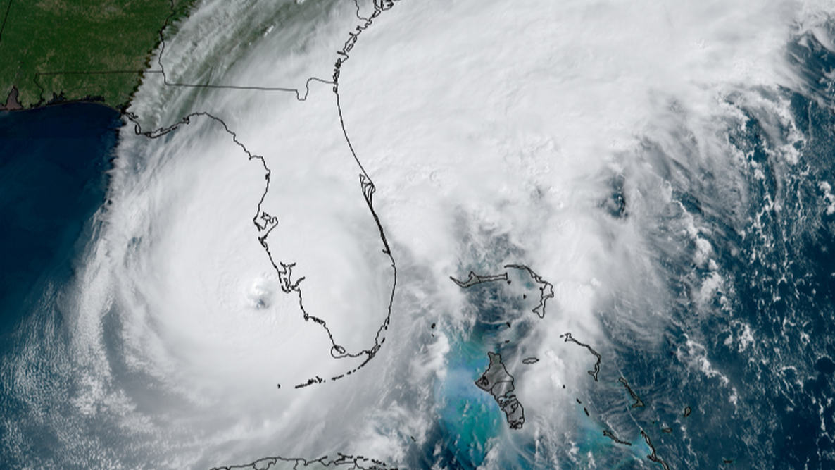
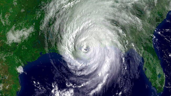
Caption
Hurricane Ian hitting Florida on September 28, 2022.
Coastal residents are looking ahead to see what the 2026 hurricane forecast has in store. According to the latest predictions from NOAA and Colorado State University (CSU), an emerging El Niño pattern is expected to drive a below-average season for tropical storm development in the Atlantic Basin. Whether you are tracking the official 2026 hurricane names, seeking the specific dates for hurricane season, or looking for expert safety definitions on storm watches and warnings, this comprehensive guide breaks down the essential 2026 predictions and weather science you need to stay prepared.
When is Hurricane Season?
The Atlantic hurricane season officially starts on June 1 and ends on November 30, though hurricanes can occur outside of the season. (In the Northeast Pacific, the season starts earlier, on 15 May.) The forecasts below cover the Atlantic Basin, encompassing the Atlantic Ocean, Caribbean Sea, and Gulf of Mexico.
Many indicators related to atmospheric and oceanic conditions indicate what to expect when it comes to hurricanes. Whatever the forecast, remember that it only takes one hurricane to make landfall, and coastal residents should prepare for every hurricane season.
Hurricane Forecasts 2026
In The 2026 Old Farmer’s Almanac, our long-range weather predictions for the year highlight when hurricanes are more likely to be active in different regions; we don’t, however, issue specific hurricane forecasts. Therefore, we have provided easy-to-read summaries by the foremost hurricane experts at NOAA and Colorado State University (CSU) with links to their full reports.
In 2026, NOAA and CSU predict a below-average Atlantic hurricane season. Learn more:
2026 NOAA Hurricane Prediction
NOAA’s outlook for the 2026 Atlantic Hurricane Season predicts a 35% chance of a near-normal season, a 10% chance of an above-normal season, and a 55% chance of a below-normal season. NOAA predicts 8–14 named storms (winds of 39 mph or higher). Of those, 3–6 are forecast to become hurricanes (winds of 74 mph or higher), including 1–3 major hurricanes (category 3, 4, or 5 with winds of 111 mph or higher).
Their forecast reflects these main factors:
El Niño is expected to develop and strengthen during the Atlantic hurricane season, which typically suppresses tropical storm and hurricane activity by increasing wind shear and limiting storm formation.
At the same time, Atlantic sea surface temperatures are expected to remain slightly above normal, and trade winds are likely to be weaker than average—both conditions that would normally support a more active season.
These competing influences create a mixed setup: the warming ocean and reduced winds favor storm development, while the emerging El Niño pattern works against it. Overall, the balance of these factors is expected to lean toward a below-normal Atlantic hurricane season.

CSU 2026 Hurricane Prediction
CSU is also predicting somewhat below-normal hurricane activity. “So far, the 2026 hurricane season is exhibiting characteristics similar to the 2006, 2009, 2015, and 2023 seasons,” said Phil Klotzbach, a senior research scientist in the Department of Atmospheric Science at CSU and lead author of the report. CSU predicts 13 named storms during the Atlantic hurricane season. Of those, CSU forecasts that 6 of these could become hurricanes, and 2 may reach major hurricane status.
The forecast reflects these main factors:
- Current weak La Niña conditions are expected to transition toward El Niño over the next several months, with the possibility of a moderate to strong El Niño developing during the peak of the Atlantic hurricane season. This shift is expected to be the dominant climate driver and is likely to increase vertical wind shear across the tropical Atlantic, which suppresses tropical cyclone formation and intensification.
- Sea surface temperatures are above normal in the western tropical Atlantic but slightly below normal in the central and eastern Atlantic, creating a mixed oceanic background state rather than a uniformly supportive warm basin.
The other big question is whether the hurricanes will hit Florida and other coastal areas. The probability of a U.S. major hurricane landfall is estimated to be below normal. As is the case with all hurricane seasons, coastal residents are reminded that it only takes one hurricane to make landfall, which makes it an active season for them. They should prepare the same for every season, regardless of how much activity is predicted.

Last Season’s (2025) Hurricane Forecast
In total, the 2025 Atlantic hurricane season produced 13 named storms, with winds of 63 kmh (39 mph) or greater, of which 5 became hurricanes, with winds of 119 kmh (74 mph) or greater. Three hurricanes reached Category 5 intensity (Erin, Humberto, and Melissa) with winds of more than 178 km/h (111 mph), according to the end-of-season tally from the U.S. National Oceanic and Atmospheric Administration (NOAA).
An average Atlantic hurricane season has 14 named storms, seven hurricanes, and three major hurricanes. But it takes just one landfalling storm to wreck communities and economies. The 2025 Atlantic seasonal activity fell within NOAA’s predictions for named storms and hurricanes.
What Are the 2026 Hurricane Names?
See the list of 2026 hurricane names for both the Atlantic Basin and Eastern North Pacific. The World Meteorological Organization’s Hurricane Committee chooses these names. The list actually repeats every 6 years unless a storm is so severe that the World Meteorological Organization votes to retire that name from future lists.
Many hurricane names have been retired since 1950 because they resulted in significant property damage or deaths. A name can be retired at the request of a country affected by the storm. See the most recent list of retired hurricane names.

Facts About Hurricanes
What Is a Hurricane?
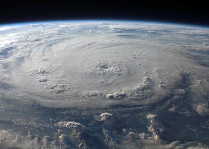
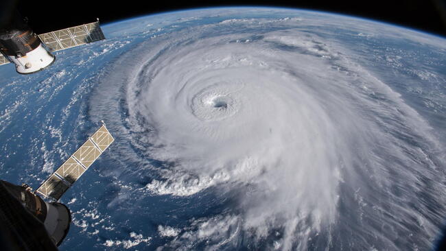
A hurricane is a tropical storm with winds that have reached a constant speed of at least 74 mph in the North Atlantic Ocean, Caribbean Sea, or Gulf of Mexico. A hurricane’s winds blow in a large spiral around a relatively calm center of extremely low pressure known as the eye of the storm. Around the rim of the eye, winds may gust to more than 200 mph. The eye of a storm is usually 20 to 30 miles wide and may extend over 400 miles. The entire storm can be up to 340 miles in diameter, dominating the ocean surface and lower atmosphere for thousands of square miles.
How Does a Hurricane Form?
Hurricanes only form over warm waters in the tropics (usually above 27°C, or about 81°F). Think of a hurricane like a giant engine. Its fuel is warm, moist air, which rises from the oceans, causing an area of lower pressure below. Then the air from surrounding areas with higher air pressure pushes into the low-pressure area. Then that “new” air becomes warm and moist and rises, too. As the warm air continues to rise, the surrounding air swirls in to take its place. As the warmed, moist air rises and cools off, the water in the air forms clouds. The whole system of clouds and wind spins and grows, fed by the ocean’s heat and water evaporating from the surface. Around their core, winds grow with great velocity, generating violent seas. Moving ashore, they sweep the ocean inward while spawning tornadoes and producing torrential rain and floods.
Storms that form north of the equator spin counterclockwise. Storms south of the equator spin clockwise. This difference is because of Earth’s rotation on its axis.
How Do We Know a Hurricane Is Coming?
Unlike tornadoes or other weather events, no hurricane goes unnoticed, thanks to satellite technology. So, pay attention to hurricane warnings!
- A hurricane watch means that hurricane-force winds are possible within 48 hours.
- A hurricane warning means that hurricane-force winds are likely within 36 hours.
See our article on “Predicting Hurricanes: The Eyes Have It” to learn more.
It usually takes several days to a week for a tropical storm to grow into a hurricane, and there is often plenty of time to take precautionary measures, unlike some extreme weather events (such as a tornado).
But if conditions are just right, a powerful major hurricane can develop in just hours. This has been called “rapid intensification” by the National Hurricane Center. When conditions are just perfect, a storm can increase its wind speed 35 mph in 24 hours or less—about two categories on the Saffir-Simpson scale, which grades hurricane strength from 1 to 5. Rapid intensification, however, is rare, with just one or two Atlantic storms per year undergoing such an acceleration.
What Is the Cause of Hurricane Damage?
Hurricanes actually weaken when they hit land because they are no longer being “fed” by the energy from the warm ocean waters. When hurricanes move over large landmasses, they can die out quickly because they lose the power of the heat and condensation. However, they often move far inland, dumping many inches of rain and causing lots of wind damage before they die out completely. So it’s not just high winds that cause danger; it’s the torrential rains and storm surges. A hurricane can last for 2 weeks or more over open water and can follow a path across the entire length of the eastern seaboard, coastal areas, and barrier islands.
Which Areas Are Most Susceptible to Hurricanes?
All Atlantic and Gulf coastal areas are subject to hurricanes or tropical storms. Although rarely struck by hurricanes, parts of the Southwest and Pacific Coast suffer heavy rains and floods each year from the remnants of hurricanes spawned off Mexico. Islands such as Hawaii, Guam, American Samoa, and Puerto Rico also are subject to hurricanes.
What is a Hurricane Vs. a Tropical Storm?
A hurricane is actually one of three kinds of tropical storms, or cyclones, that circulate over tropical waters. The circulation is counterclockwise in the Northern Hemisphere. Tropical cyclones are classified as follows:
- Tropical Depression: An organized system of clouds and thunderstorms with a defined circulation and maximum sustained winds of 38 mph (33 knots) or less.
- Tropical Storm: An organized system of strong thunderstorms with a defined circulation and maximum sustained winds of 39 to 73 mph (34 to 63 knots).
- Hurricane: An intense tropical weather system with a well-defined circulation and maximum sustained winds of 74 mph (64 knots) or higher. In the western Pacific, hurricanes are called typhoons. Similar storms in the Indian Ocean are called cyclones. Hurricanes are further classified by rank according to how strong their winds are.
How Are Hurricanes Classified, and What Are Hurricane Categories?
The Saffir-Simpson Hurricane Scale is a 1 to 5 rating based on the hurricane’s present intensity. This is used to give an estimate of the potential property damage and flooding expected along the coast from a hurricane landfall. Wind speed is the determining factor in the scale, as storm surge values are highly dependent on the slope of the continental shelf in the landfall region. Wind speeds are measured using a 1-minute average.
| Saffir-Simpson | Wind (mph) | Hurricane Examples |
|---|---|---|
| Category One | 74 - 95 | Allison (1995), Danny (1997) |
| Category Two | 96 - 110 | Bonnie (1998), George (1998), Gustav (2002) |
| Category Three | 111 - 130 | Roxane (1995), Fran (1996), Rita (2005) |
| Category Four | 131 - 155 | Opal (1995), Iniki (1992), Charley (2004), Katrina (2005) |
| Category Five | 156 + | Andrew (1992), Matthew (2016), Irma (2017), Maria (2017) |
For Almanac long-range weather predictions, find 60-day forecasts on the Website or find 12 months in the annual Old Farmer’s Almanac.

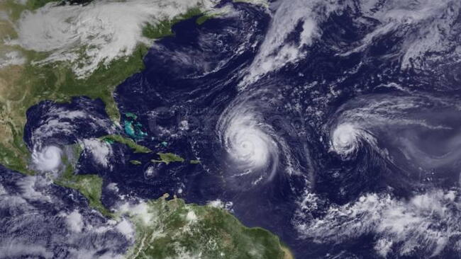

Warmer temperatures don't necessarily mean more storms. However, they can cause storms to hold more water vapor, which results in more rain and a higher potential for flooding.
Hi! The Old Farmer's Almanac is an annual publication. However, we do offer a daily newsletter called the Almanac Companion. It's free! Learn more and sign up here: https://www.almanac.com/newsletters
- « Previous
- 1
- 2
- …
- 10
- Next »

Comments