
All about El Niño's role in climate and what to expect in 2023
If you’re not familiar with the term El Niño, it’s because it’s only been studied relatively recently. But this warming of the oceans will be an important factor this winter, especially as there’s talk about a “Super El Niño.”
I remember hearing about El Nino for the first time in the late 1990’s, when my curiosity about the weather was peaking. I’d watch that cable TV channel dedicated to weather every second I could, and I also remember the Saturday Night Live spoofs with Chris Farley as “The Nino.”
I mention this because the first time an El Nino was studied in its entirety was recent, just in 1997 to 1998, when we had one of the strongest El Ninos on record.
Read Next
While this phenomenon has been happening for hundreds of years out of sight and out of mind for most of us (though fishermen in the Pacific Ocean have noticed it for centuries), we are just starting to understand the effects it can have on our seasons and long-term forecasts.
And if you want to know what to expect for winter, El Nino is an important piece of the puzzle.
What is El Niño?
El Niño, Spanish for the little boy, is the presence of warmer-than-average water temperatures in the eastern Pacific near the equator, just off the west coast of South and Central America. Its counterpart, La Niña, the little girl, is the presence of colder than average sea surface temperatures in the eastern Pacific
Along the western coast of South America, the waters are shallow and can warm easily under the right conditions. The trade winds play a large role in what happens next. Trade winds blow east to west along the equator.
If the winds are weak, the water stays put and is able to warm to above-average temperatures, El Niño. If the trade winds are strong, they push that warm surface water west and colder water fills in where the warm water was, causing lower than average temperatures, La Niña.
Learn more about El Niño and La Niña.
El Niño’s Role in Climate
It’s important to note that El Niño is just one of many phenomena we monitor from a meteorological and climatological perspective (the difference between the two is something I’ll write about soon!). There is also:
- MJO: Madden/Julian Oscillation, a large eastward moving disturbance of rain in the tropics
- AO & AAO: Arctic and Antarctic Oscillations, circulations around the poles that either allow or prevent cold air from spilling out to mid-latitudes
- NAO: North Atlantic Oscillation, pressure differences in the North Atlantic
- PNA: Pacific North American Pattern, the location of the East Asian jet stream
All of these represent teleconnections, a large-scale pressure or circulation pattern with significant links between weather at different locations on Earth. El Niño and La Niña are an important piece of the pie, but know they aren’t the only slice. However, this is what we will focus on today.
La Niña conditions have dominated the last 3 years, and as of July 2023, the Climate Prediction Center issued an advisory that El Niño has begun. At this time, we can’t say how long it will last. Typically, we are in El Niño, La Niña, or neutral on an annual basis, so the earliest we would see this end or change would be the Spring or Summer of 2024.
El Niño and La Niña can have varying intensities (weak, moderate, strong, or super) based on how many degrees above or below normal the sea surface temperatures are.
What to Expect in an El Niño Year
In an El Niño winter, whether it’s mild or strong, here’s the typical outlook.:
- The southern and southeastern United States can expect a cooler, wetter winter than average, especially during the months of November, December, and January.
- In contrast, the Pacific Northwest can expect warmer conditions than average, which peaks in December and January but can also expect more precipitation in December and January.
- Areas like the northeast and New England trend slightly warmer-than-average with near-normal or just above the usual amount of precipitation, with the usual February cold snap expected.
- The Great Lakes and upper Midwest also tend to be slightly warmer- and drier-than-average which peaks in December and January.
Historical El Niño Winters
Often, it is helpful to look back at comparable years to know what to expect this winter. Our forecast says we are heading to a strong or moderate El Niño this winter.
Here are the most recent El Niño years by strength:
- Strong El Niño in 2009 to 2010
- Moderate El Niño in 2005 to 2006 & 2002 to 2003
- Weak El Niño in 2014 to 2015
If you remember any similarities in those years such as warmer temperatures or more snow, you are likely to see that again for the winter El Niño of 2023 to 2024.
- The 2015 to 2016 Super El Niño
“Super” El Niños are rare and seem to have one exception: warmer temperatures across a much larger portion of the United States, with the 2015 to 2016 winter being warmer than average temperatures everywhere east of the Rocky Mountains, and slightly cooler temperatures west of the Rockies.
December of 2015 around the Great Lakes was extremely warm, over 13 degrees above average. The northeast saw warmer temperatures and low snowfall (despite near-normal precipitation, which means it was a rainy winter). Much of the Great Lakes and New England had their warmest winter on record.
You may see these differences if our El Niño goes from moderate or strong to super.
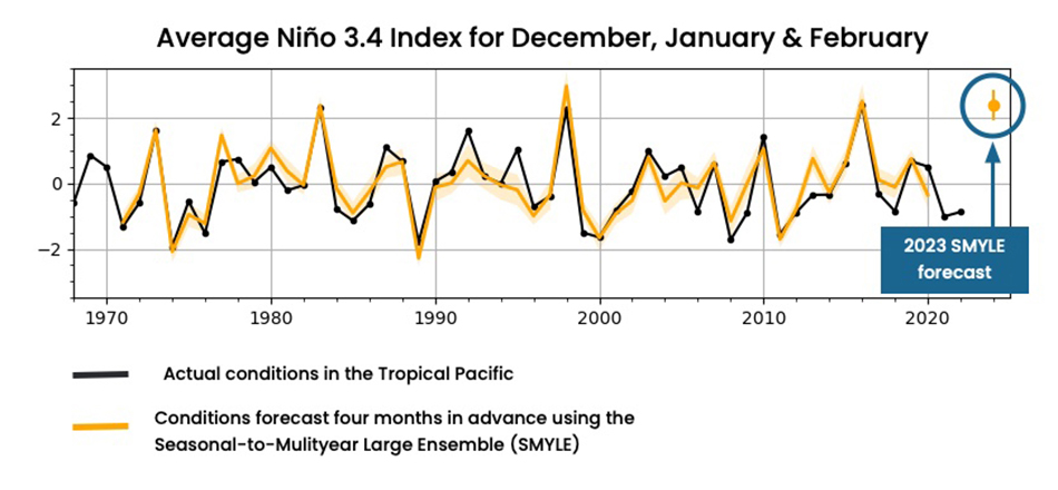
A Super El Nino for Winter 2023–2024?
We know that we’re in store for an El Niño winter. The question is: how strong? As of now, we are not expecting a “Super El Nino,” though it’s difficult to predict.
That said, in late September 2023, the National Center for Atmospheric Research released a new forecast model suggesting there are strong chance of upgrading El Niño. They suggest that we could be in store for a “Super El Nino,” a term to capture one of the strongest events on record, comparable to the 1997 to 1998 El Niño I mentioned at the start of this article. The forecast is based on historical data.
Again, if you are across the North and Pacific Northwest United States, El Niño events mean a warmer-than-average winter. The South and Southeast will experience a cooler, wetter winter than usual.
Understand that these differences are entire seasonal averages and you are still subject to the occasional heat wave or cold spell during it all. This is not a forecast of what every single day will be like, just the average of the season. If, on average, you experience 2 days a week of precipitation most winters and are forecast to see more this winter, it could be 3 or more days a week instead.
How a Super El Niño Can Affect the World
Super El Niños can have catastrophic consequences across the world. The pacific hurricane season of 2015–2016 was record breaking with 16 tropical cyclones, more than 3 times the annual average from 1981–2010.
- The Caribbean experienced drought and water rationing like they had not seen since 1928. Water reserves went dry and over half of the farms went out of business.
- Drought across Asia had dire consequences but also led to severe wildfires, which contributed to record poor air quality across southern Asia.
- And the most severe coral bleaching event of the Great Barrier Reef off the coast of Australia happened during the El Niño of 2015 to 2016.
Stay tuned. We’ll better understand the El Niño strength and impact for our winter in the coming months.
Find out what The Old Farmer’s Almanac is predicting for winter 2023–2024.
Cyrena Arnold


ADVERTISEMENT
Most articles concerning El Nina vs El Nino vs Neutral years are typically confusing as written. In a nutshell, El Niño contributes to more eastern and central Pacific hurricanes and fewer Atlantic hurricanes while, conversely, La Niña contributes to fewer eastern and central Pacific hurricanes and more Atlantic hurricanes. In the transition from a normal year to El Niño the trade winds weaken and even reverse allowing the warm water in the west to flow eastward towards the Central and Eastern Pacific bringing the convective storms with it. Areas of the Eastern Pacific tend to get more rain while those if the Western Pacific receive less. La Niña refers to the periodic cooling of sea-surface temperatures across the east-central equatorial Pacific. El Niño conditions lead to wetter, snowier conditions. La Niña conditions lead to drier and warmer temperatures overall, with notable extreme cold spells. In stronger "super" El Niño or La Niña episodes, these trends are even greater.
I didn't find the article hard to follow: El Nino typically brings warmer/less severe winter to New England, but the Super El Nino of '97/'98 was special. That winter brought the worst ice storm northern New England had ever seen. We were without power for a week, and some even went without for well over a week as crews worked to restore it around downed trees, poles and anything else that couldn't take that kind of icy weight.
The winter of '08/'09 also included a horrendous ice storm with people without power for over a week. The storm knocked out my cable, but not my power, so my siblings came for hot food and showers while we watched old VHSs.
Long stories short: if you're in New England, get your supplies ready for more ice storms and don't act surprised when they happen. We've done it before, and we can get through it again 💪
Kendra and Phyllis I agree with both of you. The article was scattered and difficult to follow but I'm pretty sure the SW US was forgotten in all the predictions for the rest of the world.
The article does not mention an entire region of the county. How does El Niño affect the west/southwest region, i.e. Nevada, Utah, Arizona, New Mexico, Colorado, Wyoming, Montana, etc?
Great article......unfortunately - because the info continued to go back & forth....its hard to even remember what you have read.
Wait a minute. You said lots of rain, but then you cite horrific droughts. I remember these years for my area, the SE US as very warm and less rain than usual. But I predict a chilly, rainy winter with little or no snow for us. Early spring!:) We'll see how me and the wooly worms and persimmon seeds do in forecasting!;)
Alyssa what continent are you speaking of N. A. OR CARRIBEAN