
Hurricane Hilary could dump a year's worth of rain
Weather watchers! There is a unique storm headed towards Southern California that will make history if the weather forecasts are accurate. This is the first-ever tropical storm watch for an area not prepared for the year’s worth of rain that Hilary could bring. Take a look!
Hurricane Hilary is churning in the eastern Pacific as a Category Four storm as of the afternoon of Friday August 18. Heading north-northwest, Hurricane Hilary is making its way towards Southern California, as you can see from the National Hurricane Center cone of uncertainty forecast.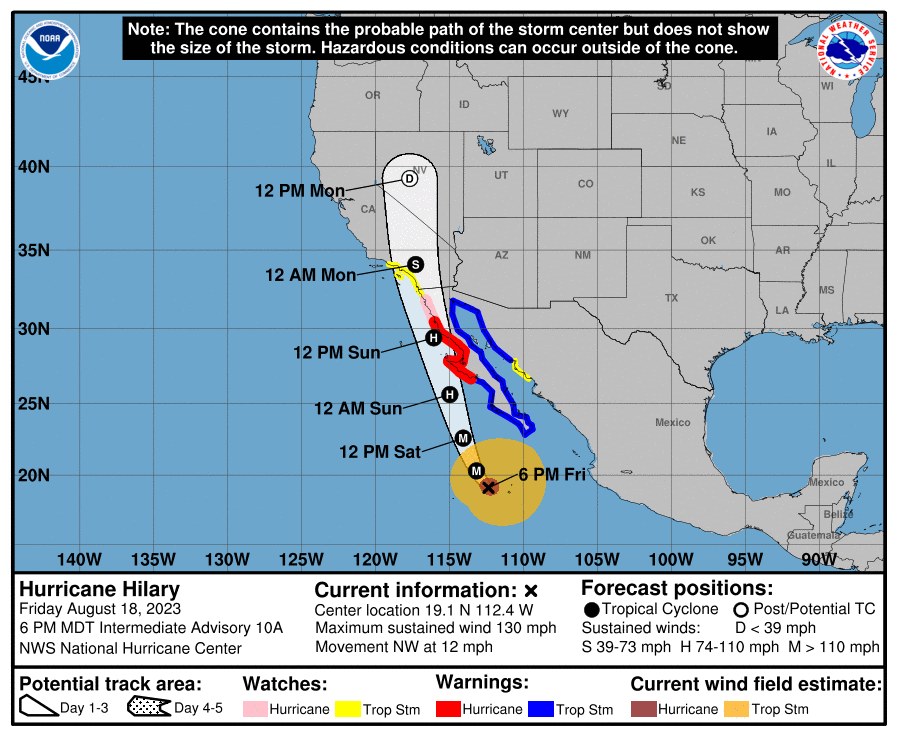
The good news is the storm is going pass through colder waters this weekend, which will weaken it from a major hurricane (Category 3, 4, or 5) to a lower grade hurricane (Category 1 or 2). Hilary is forecast and make landfall as a category 1 storm or as a possibly weaker tropical storm late Sunday evening or early Monday morning.
Read Next
The last time a tropical storm hit Southern California was back in 1939, and this was simply a tropical storm, not even a category one hurricane. This rarity of a tropical storm in Southern California is very concerning to meteorologists because not only has the population in Southern California changed drastically since 1939, but a category one storm has never hit these areas so we don’t know what the true impacts will be.
Considering recent burn scars, past droughts, summer flooding, and the steep terrain that is found in Southern California, the flash flooding and damage risk is going to be extremely high. Flooding is the most dangerous and deadly part of a hurricane, so residents and visitors need to have a plan to evacuate the area or be sure to seek higher ground.
Lastly, the ocean is going to be dangerous leading up to the storm. Storm surf (rough ocean waves and currents) and storm surge (the flood a hurricane brings before and during a storm) are extremely dangerous. This part of the country is not accustomed to experiencing these conditions and will need to take extra precautions.
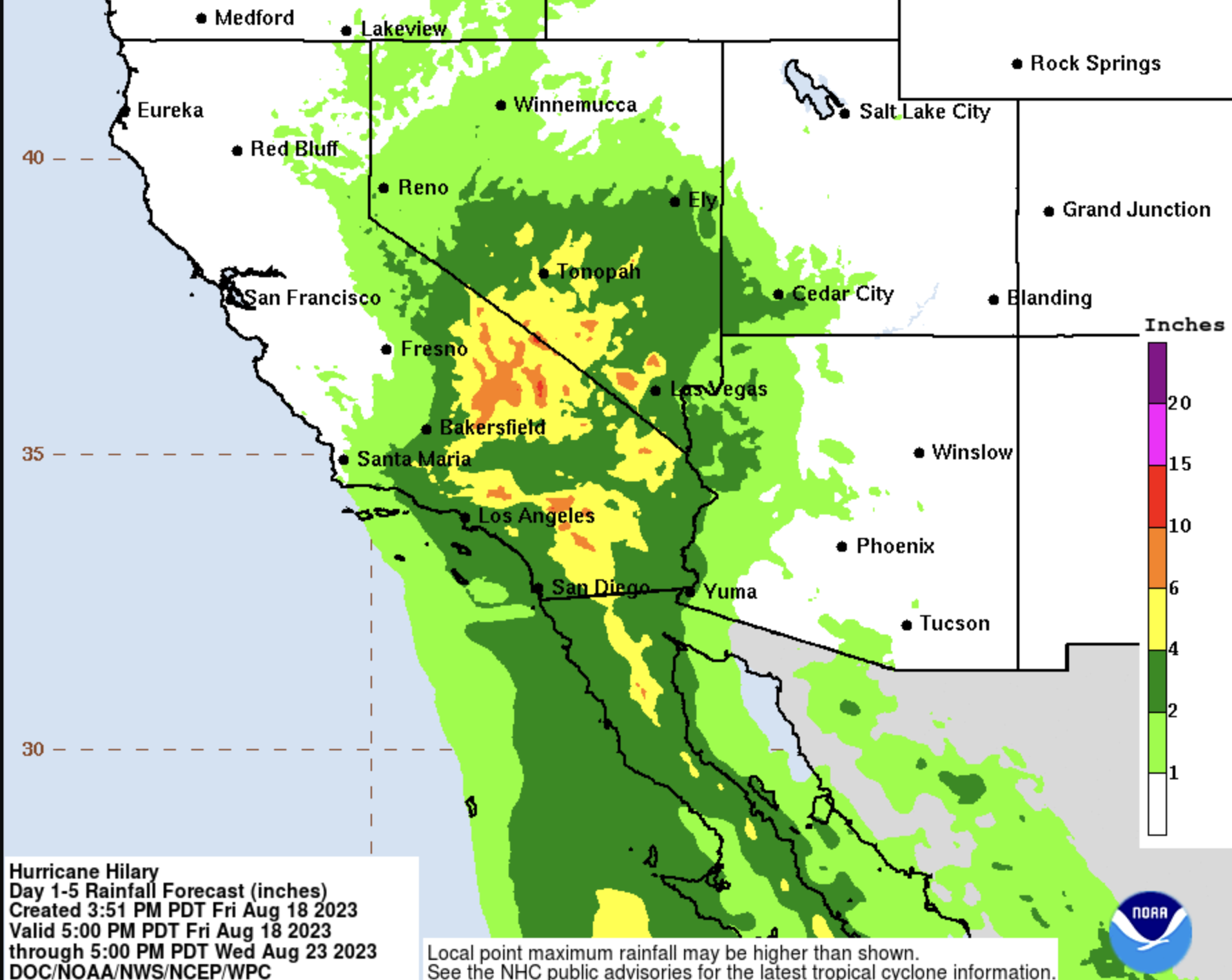
The risk of flash flooding is extremely high in Southern California for the duration of Hurricane Hilary. The forecast rainfall map from the National Hurricane Center shows 10 to 15 inches falling over many locations with local higher amounts possible. This is more rain than some of these places see in a year or more total. See tips on how to survive a flood now.
Meteorologists at the National Hurricane Center will be keeping their eye on this storm as it has the potential to be a record breaking and dangerous event for the area. Prepare now: See hurricane safety information.
Watch Meteorologist Cyrena Arnold’s Report
–Author Cyrena Arnold is a meteorologist with over 20 years of experience, from installing weather stations on the remote Alaska tundra to Director of Summit Operations for the Mount Washington Observatory to an NH1 News TV Meteorologist. She has also written a children’s book about the weather called, “The Weather Story”, is a storm chaser, and was Mrs. New Hampshire 2022. Find Cyrena on an social media @WxCyrena or visit her website WxCyrena.com
Cyrena Arnold


ADVERTISEMENT